India backs UN ‘Correct the Map’ resolution but draws red line over Jammu & Kashmir, Ladakh
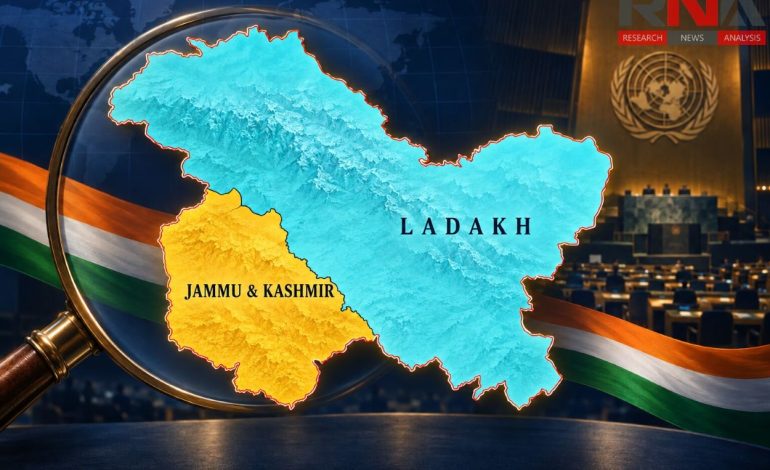
RNA Media illustration for resolution.

New Delhi: India has supported a United Nations resolution promoting more proportionate representations of the world’s landmasses, while making clear that the initiative cannot alter the country’s internationally depicted boundaries. New Delhi said Jammu & Kashmir and Ladakh must be shown in accordance with India’s official map and rejected any inaccurate or misleading representation of its sovereign territory.
The clarification followed India’s vote in favour of the resolution, titled “Correct the Map: Rebalancing Global Cartographic Representation and Promoting Equitable Representation of the World’s Regions, Particularly Africa”. The UN general assembly adopted the non-binding measure on Friday, with 164 countries voting in favour, the United States opposing it and six countries abstaining.
The External Affairs Ministry spokesman, Randhir Jaiswal, said India had supported the underlying principle of equal-area cartographic representation rather than any particular world map. He stressed that the resolution did not amount to an endorsement of a specific projection or portrayal of national boundaries.
“India’s sovereign territory, including the Union territories of Jammu & Kashmir and Ladakh, must be depicted in accordance with India’s official map,” Jaiswal said. He described New Delhi’s position on sovereignty and territorial integrity as “clear, consistent and non-negotiable”.
India’s official map includes the entirety of Jammu & Kashmir and Ladakh, including territories that New Delhi says are under the illegal occupation of Pakistan and China. The government has consistently maintained that cartographic representations published by international organizations, foreign governments and commercial entities must reflect that position.
The distinction drawn by New Delhi is important because map projection and political cartography are separate issues. A projection determines how the curved surface of the Earth is represented on a flat sheet or screen, while political cartography concerns borders, disputed territories, place names and questions of sovereignty.
Why the UN wants maps corrected
The resolution, circulated as draft A/80/L.104 and sponsored by Togo on behalf of the African Group, encourages wider consideration of equal-area projections. It seeks to correct the visual imbalance created by conventional maps that exaggerate the size of landmasses farther from the Equator while diminishing equatorial regions, particularly Africa.
Much of the debate concerns the Mercator projection, developed by the Flemish cartographer Gerardus Mercator in 1569 primarily to assist maritime navigation. Its ability to preserve angles and directions made it valuable to sailors, but the same mathematical design substantially enlarges high-latitude regions when used as a general world map.
The distortion is most easily demonstrated by comparing Greenland with Africa: the two can appear broadly similar in size on a Mercator map, although Africa is about 14 times larger. Such representations have influenced classrooms, atlases, news graphics and public perceptions of the relative geographical weight of different regions for generations.
The African-led campaign has promoted projections such as Equal Earth, created in 2018, which preserve the relative areas of continents and countries more faithfully. The resolution does not outlaw the Mercator projection or compel governments and institutions to adopt a single replacement, but encourages schools, media organizations, international institutions and digital platforms to consider equal-area alternatives.
Explaining India’s vote, the first secretary at the country’s permanent mission to the UN, Raghoo Puri, said different projections served different cartographic purposes and that no single design was appropriate for every application. India argued that the resolution should remain technologically and methodologically neutral, leaving countries, institutions and cartographers free to select projections according to their requirements.
New Delhi consequently treated the initiative as a technical effort to represent the relative size of continental landmasses more accurately, not as an exercise in redrawing borders. The resolution neither resolves territorial disputes nor changes the legal or diplomatic positions of UN member states on contested regions.
India’s vote also aligns with its wider diplomatic support for greater African representation in global institutions, including its role in securing permanent membership of the G20 for the African Union in 2023. Its accompanying explanation of vote, however, ensured that support for Africa’s cartographic campaign could not be interpreted as accepting any map that departed from India’s stated territorial boundaries.