


Nepal’s worst floods do not always start with rain. This week’s disaster shows why
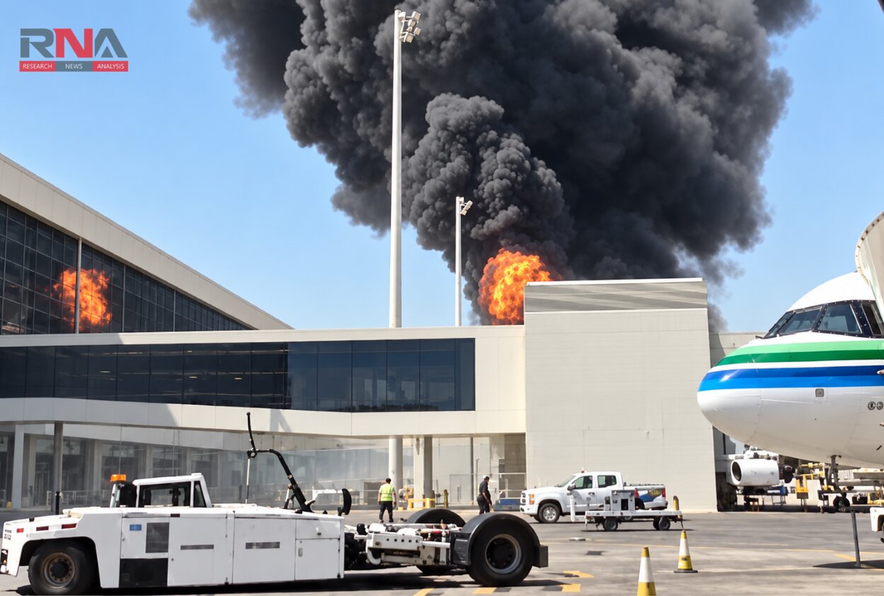
RNA Media illustration for representation.

New Delhi: On the morning of Wednesday, 26 August, a sudden flash flood swept down the Bhote Koshi river from the Tibetan side of the border into Nepal’s Rasuwa district, tearing through Timure and Syabrubesi before surging into the Trishuli river. The flood then moved towards Nuwakot, Dhading, Gorkha and Chitwan, leaving a trail of destruction along the river system. By Thursday, the death toll had risen to about 180, while nearly 1,500 people remained missing across Nepal and Tibet, including more than 700 foreign nationals.
As RNA Media reported, the event was initially reported as a magnitude 4.4 earthquake, but the US Geological Survey (USGS) later determined that no earthquake had occurred. The agency said the seismic signal, recorded as a 5.2 magnitude event near the Nepal China border, was instead generated by a glacial collapse and the debris flow that followed.
What triggered the disaster is still being investigated, but officials believe an ice-and-rock collapse on the Tibetan side of the border, that caused a sudden surge of water downstream. About 180 people have died and roughly 1,500 remain missing, while Bihar and Uttar Pradesh are on alert as the floodwaters move towards India.
Here’s the question worth sitting with: why does this keep happening to Nepal, specifically, and not to other mountainous countries in quite the same brutal, recurring way?
Why Nepal’s geography makes flash floods so destructive
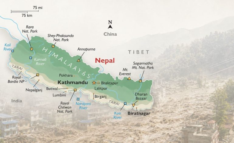
Look at Nepal on a map and its geography immediately explains part of its flood risk. Nepal is landlocked between China’s Tibet region and India, stretching about 800 kilometres east to west but only 150–250 kilometres north to south. Within that narrow stretch, the terrain rises from the Terai plains at around 60 metres to Mount Everest at 8,849 metres, with eight of the world’s 14 peaks above 8,000 metres located in the country.
That combination, with the country barely 150 kilometres wide in places and some of the world’s highest mountains within it, leaves little room for water to spread out. Water or debris released near the Tibetan border can fall nearly nine vertical kilometres through steep, narrow valleys that funnel the flow rapidly towards the plains.
Nepal’s three main river systems, the Koshi, Gandaki and Karnali, flow south from the Himalayas towards India and eventually into the Ganges. Add the monsoon, which brings about 80% of Nepal’s annual rainfall between June and September, and the risk increases sharply. Nepal’s 2024 Disaster Report recorded 927 flood incidents and 260 deaths in just six monsoon seasons.
A history that keeps repeating itself
Nepal’s flood problem is hardly new. From the Dig Tsho Glof in 1985 to the latest disaster along the Bhote Koshi and Trishuli, the triggers have changed, but the pattern remains the same: an event in the mountains sends water and debris rapidly downhill, putting communities downstream at risk.
In 1985, an avalanche from the Langmoche glacier breached Dig Tsho lake in the Everest region, releasing about 5 million cubic metres of water. At least five people were killed, 15 bridges were washed away and a hydropower plant was destroyed.
In 1993, a monsoon cloudburst triggered floods and debris flows that killed about 1,336 people. In 2008, the Koshi embankment breached at Kusaha, sending floodwaters into Nepal and Bihar and affecting lakhs of people.
Major floods and landslides struck Kaski in 2012, parts of Nepal in 2016 and western Nepal, including Myagdi, in 2020. The events had different triggers, but showed the same vulnerability: heavy rain or a sudden release of water can quickly become destructive in Nepal’s steep terrain.
In 2021, a debris flood devastated Melamchi, killing five people and leaving 20 missing while damaging the Melamchi Water Supply Project. In 2024, the Thame GLOF displaced 135 people and destroyed 25 homes, according to ICIMOD.
The September 2024 floods showed that glaciers are not always involved. Heavy monsoon rain triggered widespread flooding and landslides, killing more than 200 people, while a July 2025 flood in the Rasuwa and Bhote Koshi corridor again exposed the risks facing communities and infrastructure in the mountains.
The latest disaster brings the pattern into focus once again. An apparent ice and rock collapse near the Nepal Tibet border sent a sudden surge through the Bhote Koshi and Trishuli systems, leaving about 180 people dead and roughly 1,500 missing as rescue operations continued.
The causes may differ, but the geography keeps amplifying them. Whether the trigger is rain, a landslide, a breached embankment or a glacial lake outburst, an event high in the mountains can quickly become a disaster downstream.
And those rivers do not stop at Nepal’s border.
How Nepal’s rivers carry the flood risk into India
When we look at the river system on a map, the connection with India becomes clear. The Bhote Koshi feeds into the Trishuli, which meets the Kali Gandaki at Devghat to form the Narayani, before entering India near Valmikinagar in Bihar, where it is known as the Gandak.
That is why Bihar is watching developments in Nepal so closely. The Narayani at Nepal’s Devghat gauge stood at 4.77 metres, below its warning level of 7.30 metres and danger mark of 9 metres, according to reports citing Bihar officials.
Floodwaters from Nepal eventually reached the Gandak Barrage at Valmikinagar, prompting Bihar to open all 36 gates as a precaution. According to reports, the discharge peaked at around 1.50 lakh cusecs on Wednesday night before beginning to recede on Thursday morning.
The exposure is built into Bihar’s geography. The state’s food management Information system says 65% of the catchment area of its rivers lies in Nepal and the Tibetan plateau, leaving Bihar heavily dependent on what happens upstream.
Uttar Pradesh faces a similar risk along the Gandak system, with Maharajganj and Kushinagar placed on alert as authorities monitored the possibility of rising river levels.
India and Nepal already have mechanisms for sharing flood information, including the joint team on flood forecasting and committees dealing with the Kosi and Gandak projects, according to the Ministry of Home Affairs.
The latest disaster shows that Nepal’s flood risk does not end at its borders. When rivers from the Himalayas flow into India, what happens upstream can quickly shape the situation downstream, making cross border monitoring and early warnings critical for communities in Bihar and Uttar Pradesh.