


Human-caused warming likely contributed to slope instability behind Nepal-Tibet floods, scientists say
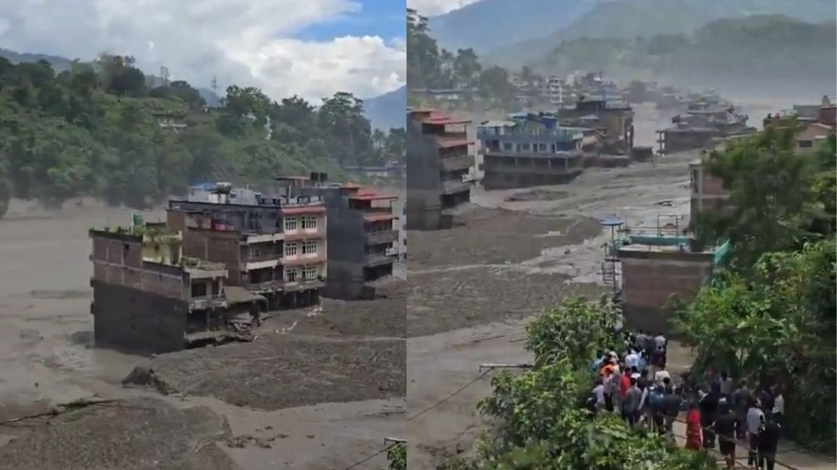
Floodwaters devastate settlements in Nepal. Image courtesy: Screen grabs via X.com

New Delhi: Human-caused global warming likely made the conditions behind last month’s catastrophic Nepal-Tibet floods more favourable to slope failure by accelerating glacier retreat, thawing mountain permafrost and weakening high-altitude rock, a new World Weather Attribution analysis released on Thursday has found. Researchers stressed that climate change was a destabilizing factor, not the sole cause of the August 26 disaster.
The event began when a large section of rock on the north facing slope of Langtang Lirung in Nepal’s Rasuwa district collapsed from about 5,150 metres, bringing down part of the overlying glacier. The rock-ice avalanche fell roughly 1,400 metres, transformed into a debris flood and then a water dominated flash flood that tore through the Bhote Koshi-Trishuli river corridor, destroying communities, roads, bridges, hydropower facilities and border infrastructure.
Nepal’s disaster authority said on Wednesday that 1,403 bodies had been recovered and 6,150 people remained missing after figures were revised following verification in affected districts. China’s latest published count stands at 43 dead and 519 missing in Tibet.
The Guardian, citing the new World Weather Attribution analysis, reported that researchers examined long-term warming, glacier retreat, permafrost degradation and geological instability to understand the conditions behind the August 26 collapse.
As RNA Media reported earlier, the August 26 disaster differed from a conventional rainfall-driven flood, underscoring the complexity of high-altitude Himalayan hazards.
World Weather Attribution, an international scientific collaboration, said glaciers in the region have been losing mass for decades at a rate equivalent to more than half a metre of thinning each year. The Langtang Lirung glacier has retreated by about half a kilometre since the 1990s, exposing rock previously covered by ice.
Warming is also degrading mountain permafrost, where ice inside fractures can help bind rock together. As that ice thaws, fractures can weaken while additional meltwater can raise water pressure within the slope.
The analysis found that the elevation of the 0°C freezing threshold has been moving upwards by roughly 100 metres a decade during the monsoon and post monsoon seasons. This exposes increasingly high elevations to longer periods above freezing and contributes to glacier thinning, permafrost degradation and changes in the balance between snowfall and rainfall.
Researchers estimated that human caused climate change added about 1.5°C to July-August temperatures around the failure site. July and August were also substantially warmer than the climatological average, increasing snow and ice melt before the collapse.
Climate was not the only factor
The analysis did not establish whether the collapse would have happened without climate change. Researchers said the underlying geological structure determined where and how the slope failed, while warming related processes likely reduced its stability over time.
Nepal’s magnitude-7.8 earthquake in 2015 may also have weakened the rock mass. Scientists said its precise contribution to the 2026 failure could not yet be confirmed.
The failure involved roughly 110 million cubic metres of rock and ice across about two square kilometres of the mountain face. Its impact released seismic energy comparable to a magnitude-5.5 earthquake before the debris surged downstream.
The disaster also exposed the limits of conventional early warning systems. Rainfall driven floods and some glacial lake outburst floods can be monitored in advance, but sudden high-altitude rock-ice avalanches can develop within minutes and remain extremely difficult to predict.
World Weather Attribution said no existing early warning system could have provided sufficient lead time to prevent the scale of impacts in the worst hit areas. Better high-altitude earth observation, hazard monitoring, risk communication and cross-border data sharing could reduce future risks, although researchers said events of this magnitude can exceed existing adaptation measures.
The International Centre for Integrated Mountain Development has since convened more than 80 experts and officials from Nepal, India, China, Bhutan and Bangladesh to examine lessons from what it has proposed calling the Lirung ice-rock avalanche.
The findings have wider relevance across the Himalayan region, where glacier retreat, permafrost degradation and earthquake prone terrain intersect with settlements, roads and hydropower infrastructure concentrated in narrow river valleys. Nepal has separately sought $20 million from the Fund for Responding to Loss and Damage (FRLD) following the disaster, while scientists continue to stress that warming was one component of a complex chain of climatic and geological processes.