


Nepal cannot find original Sugauli Treaty. What is the 1816 pact that still shapes its border dispute with India?
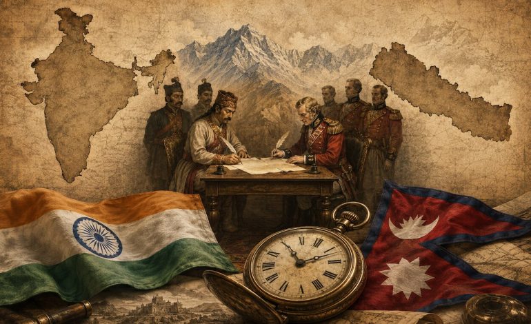
RNA Media illustration for representation.

New Delhi: Nepal cannot confirm whether it possesses the original signed copy of the 1816 Sugauli Treaty, the document it relies upon to support its territorial claims over Lipulekh, Kalapani and Limpiyadhura. The admission has drawn attention to the country’s archival record just days after India and China resumed traditional border trade through the strategically important Lipulekh pass.
The Nepali foreign minister, Shisir Khanal, told his country’s parliament on Monday that the government held documents associated with the Sugauli Treaty and the 1950 Nepal-India Treaty of Peace and Friendship. However, it had no conclusive information establishing whether any of the papers were the original official instruments signed by the respective parties.
Khanal was responding to a question from the Nepali Congress lawmaker, Nishkal Rai, who had asked whether the government possessed the original copies of the two treaties. Some treaty-related documents were held at the Nepal National Archives, Khanal said, but their status and authenticity had not been established.
The statement requires a careful distinction: Nepal has not formally declared that the Sugauli Treaty has been lost, but it cannot authenticate the papers in its possession as the original treaty. That uncertainty is significant because the agreement is central to Kathmandu’s historical and cartographic case in one of South Asia’s longest-running boundary disagreements.
A search for the documents had earlier been undertaken by the Delegated Legislation and Governance Committee of Nepal’s National Assembly. On July 22, the committee concluded that it had been unable to find the original copies of either the Sugauli Treaty or the 1950 peace and friendship treaty, according to Kathmandu Post.
The committee said it had examined possible repositories, including the country’s national archives, the archaeology department, the Narayanhiti Palace Museum and the foreign affairs and law ministries. Libraries, government archives and other locations where historical state papers might have been preserved were also searched without producing a verifiable original.
Questions over the safekeeping of the treaties are not new. In 2019, the-then Nepali foreign minister, Pradeep Gyawali, told Parliament that his ministry possessed copies of both agreements but could not determine whether they were originals without forensic examination.
Gyawali said Nepal was also trying to locate historical documents and maps in India and the United Kingdom. The search reflected the complex provenance of papers produced when the treaty relationship involved the Nepali court, the British East India Company and, later, the government of British India.
The uncertainty surrounding the 1950 treaty surfaced more directly in 2016, when the Eminent Persons’ Group on Nepal-India Relations began examining whether the agreement should be revised or replaced. Nepal could not locate its original copy and instead supplied another copy to the Nepali side of the group, led by the diplomat, Bhekh Bahadur Thapa.
The archival controversy has returned at a diplomatically sensitive moment. India and China resumed traditional border trade through Lipulekh on August 1 after the route had remained closed since the Covid-19 pandemic, prompting renewed criticism in Nepal because Kathmandu includes the pass within its official territory.
Nepal maintains that Limpiyadhura, Lipulekh and Kalapani lie east of the Kali river and therefore fall within its borders under the Sugauli Treaty. India administers the area as part of Pithoragarh district in Uttarakhand and rejects Nepal’s claim as neither justified nor supported by historical facts and evidence.
New Delhi also maintains that trade and pilgrimage through Lipulekh represent a long-established practice. India and China have treated the pass as a bilateral trading point for decades, while Nepal argues that neither country should enter arrangements involving the route without consulting Kathmandu.
The missing original does not automatically invalidate the treaty or settle the competing territorial claims. Treaty texts preserved in official collections, authenticated copies, subsequent agreements, diplomatic correspondence, administrative records, survey material and historical maps can all carry evidentiary value in determining the meaning and application of an international boundary arrangement.
Its absence nevertheless creates an uncomfortable problem for Kathmandu because different historical maps offer competing depictions of the river system and the border. An original treaty package, particularly if accompanied by authenticated maps, annexures, seals or related correspondence, could help establish what the parties understood when the agreement was concluded.
What is the Sugauli Treaty?
The Sugauli Treaty was the peace agreement that ended the Anglo-Nepalese War of 1814–1816 between the Kingdom of Nepal and the British East India Company. It curtailed Nepal’s territorial expansion, defined much of the country’s subsequent geographical shape and placed its relations with British India on a new diplomatic footing.
The conflict arose after the Gorkha kingdom, established through the unification campaigns begun under King Prithvi Narayan Shah, expanded rapidly across the Himalayas. By the early 19th century, Nepali authority had moved westwards into Kumaon and Garhwal and eastwards towards Sikkim, bringing it into growing contact and conflict with territories controlled or protected by the East India Company.
Disputes over taxation, forest resources and jurisdiction in the Himalayan foothills contributed to repeated clashes along a frontier that had never been comprehensively surveyed. The East India Company declared war in November 1814, expecting a relatively quick campaign but encountering determined resistance from Nepali forces fighting in difficult mountain terrain.
The British initially suffered setbacks, and Nepali commanders established a reputation for discipline and resilience that later contributed to the recruitment of Gurkha soldiers into British service. The East India Company eventually reorganized its campaign, brought greater military resources to bear and made decisive gains under Major General David Ochterlony in the western theatre.
Nepal’s military position deteriorated after the fall of key defensive locations and the withdrawal of its forces from Kumaon and Garhwal. Negotiations produced a treaty at Sugauli – also spelt Segowlee or Sugowlee in older records – in present-day Bihar on December 2, 1815.
The Nepali court did not immediately ratify the terms, which it regarded as severe. British forces consequently resumed their advance towards Kathmandu, and Nepal delivered the ratified agreement on March 4, 1816, bringing the war formally to an end.
The treaty contained nine articles covering peace, territorial concessions, pensions for affected Nepali officials and the future diplomatic relationship between the two sides. Its surviving published text bears the date December 2, 1815, although it is generally known as the Treaty of Sugauli of 1816 because that was when ratification made it effective.
Under Article II, Nepal renounced claims to lands that had been contested before the war and acknowledged the East India Company’s sovereignty over them. Article III listed extensive territorial cessions, including lowlands between several major rivers, land in the eastern hills and areas that Nepal had acquired during its earlier expansion.
Nepal relinquished its control over Kumaon and Garhwal in the west and territories connected with Sikkim in the east. The settlement also involved large parts of the Tarai, although some lowland territories were restored to Nepal through arrangements concluded shortly afterwards and further areas were returned in 1860.
Article IV attempted to compensate Nepali chiefs and senior officials whose interests were damaged by the territorial transfers. It provided for pensions totalling ₹200,000 a year, to be allocated among individuals selected by the king of Nepal.
Article V became the most consequential clause for the present India-Nepal dispute. It stated that the king of Nepal renounced, for himself and his successors, all claims to or connections with countries lying west of the Kali river.
The clause made the river the decisive geographical reference for Nepal’s western limit, but it did not define where the Kali began. It contained no coordinates, detailed description of the headwaters or authoritative map identifying which of several high-altitude streams should be regarded as the river’s principal source.
That omission had limited immediate significance in an age when many Himalayan frontiers were sparsely populated, poorly mapped and administered through local arrangements. Two centuries later, however, the precise identity of the river’s source determines whether a strategically valuable wedge of mountain territory falls on the Indian or Nepali side of the boundary.
Nepal argues that the Kali originates at Limpiyadhura, the northwesternmost of the possible headwater locations. On that interpretation, the land east of the stream flowing from Limpiyadhura – including Limpiyadhura, Kalapani and Lipulekh – belongs to Nepal under Article V.
India follows a different interpretation of the river system and the boundary near Kalapani. It has relied on historical survey material, administrative practice and maps showing the disputed area within the territory administered first by British India and subsequently by independent India.
The distinction involves more than a disagreement over the name attached to a river. Several streams descend through the high-altitude terrain before joining the main Kali-Mahakali system, and identifying one stream rather than another as its source shifts the border and the trijunction with China.
Nepali arguments frequently cite early 19th-century maps that show the Kali rising near Limpiyadhura. Indian assessments point to other cartographic and administrative records, including material that treats the stream emerging near Kalapani as the relevant headwater and places Lipulekh on the Indian side.
Historical maps are not uniform, and their evidentiary value depends on their date, authorship, official status, scale and relationship to actual administration. Maps prepared for military, revenue or general geographical purposes may depict the same terrain differently, particularly when the original treaty did not annex a mutually accepted boundary map.
The dispute is further complicated by what happened after 1816. British officials administered the Himalayan region, conducted surveys and altered cartographic depictions over time, while local communities continued to use mountain routes for grazing, commerce, pilgrimage and movement across what later became more rigid international frontiers.
Nepal contends that some later British maps shifted the river’s origin eastwards and thereby reduced the territory falling on the Nepali side. India argues that historical administration and long-standing practice support its control, and that Nepal’s expanded territorial assertion emerged much later than the treaty itself.
The agreement also reshaped Nepal’s eastern and southern limits. Article VI required Nepal not to interfere with the ruler of Sikkim and provided for the British government to arbitrate disputes between the two Himalayan states, illustrating the substantial influence the East India Company acquired over regional affairs after the war.
Article VII restricted Nepal from employing British, European or American subjects without British consent. Article VIII provided for accredited representatives to reside at each other’s court, resulting in a British resident being stationed in Kathmandu and opening a lasting, although often uneasy, formal relationship.
The treaty was therefore more than a boundary settlement. It limited Nepal’s territorial ambitions, expanded British strategic influence along the Himalayan belt and created a framework through which the East India Company could monitor political developments in Kathmandu without directly annexing the kingdom.
Nepal nevertheless retained its separate political identity and was not absorbed into British India. Its continued sovereignty, combined with the military reputation earned by Nepali soldiers, helped lay the foundations for a relationship in which Gurkhas were recruited into British service and Nepal later supported British campaigns in the region.
The territorial outcome of 1816 was not entirely permanent. Some eastern Tarai land was restored to Nepal in December 1816 after the East India Company reconsidered the administrative and financial burden of governing the ceded territory and Nepal agreed to forgo the pensions promised under Article IV.
A further adjustment followed Nepal’s support for the British during the 1857 uprising in India. Under the 1860 boundary settlement, the British returned the western Tarai districts that now broadly correspond to Banke, Bardiya, Kailali and Kanchanpur, an area remembered in Nepal as “Naya Muluk” (new country).
These later transfers explain why Nepal’s present boundary cannot be understood solely by reading the nine articles of the original Sugauli Treaty. The treaty remains foundational, but subsequent agreements, survey work, administrative decisions and conduct by the parties also form part of the historical record.
The modern Kalapani disagreement acquired sharper political visibility in the final decades of the 20th century. India has maintained security forces in the area and regards Lipulekh as an established route for trade with Tibet and for the Kailash Mansarovar pilgrimage, while Nepal has increasingly pressed for a settlement based on its interpretation of the Kali’s headwaters.
India and China identified Lipulekh as a route for trade and pilgrimage in agreements and understandings without Nepal being a party to them. Kathmandu has objected that such arrangements prejudge a trijunction that cannot be finalized until India and Nepal resolve their bilateral boundary.
The issue escalated substantially in May 2020 after India inaugurated an upgraded road from Dharchula towards Lipulekh for pilgrims travelling to Kailash Mansarovar. Nepal protested, released a revised political map incorporating Limpiyadhura, Lipulekh and Kalapani, and amended its Constitution in June 2020 to place the map in the national emblem.
India rejected the change as an artificial enlargement of Nepal’s territory and said unilateral cartographic action could not alter historical facts or established administration. It nevertheless maintained that outstanding boundary questions should be addressed through diplomatic dialogue in an atmosphere free from politicization.
The dispute carries strategic importance because Lipulekh lies close to the India-Nepal-China trijunction and provides one of the shortest established routes between the Indian plains and the Tibetan plateau. It is commercially useful, important for the Kailash Manasarovar pilgrimage and sensitive from a military standpoint because it overlooks approaches through the central Himalayan sector.
For Nepal, the issue is also connected with sovereignty, national identity and the memory of territorial losses imposed after military defeat. Political parties across the ideological spectrum have found it difficult to compromise on territory now incorporated into the country’s Constitution and official map.
For India, accepting Nepal’s interpretation would require relinquishing territory under long-standing Indian administration and could affect an established border route with China. New Delhi therefore emphasizes effective control, historical usage and documentary evidence that it says contradict Kathmandu’s reading of the treaty.
The absence of Nepal’s authenticated original copy does not erase Article V or end Kathmandu’s claim because the treaty’s wording is widely preserved and not seriously disputed. Nor does possession of an original document necessarily answer the geographical question unless it includes a mutually accepted map or accompanying material identifying the Kali’s source.
What the archival uncertainty does reveal is the importance of assembling a complete evidentiary record. A serious boundary process would have to compare treaty texts, ratification papers, early surveys, revenue records, official correspondence, local administrative practice and maps held in Nepal, India and British archives.
It would also have to distinguish between the legal boundary created in 1816 and any subsequent practice capable of clarifying, modifying or reinforcing that boundary. Neither a recently printed political map nor a single colonial-era chart can, by itself, resolve a dispute shaped by two centuries of conflicting cartography and administration.
India and Nepal have successfully demarcated most of their approximately 1,800-kilometre boundary, and their officials have worked through joint mechanisms on border pillars and other local problems. Kalapani-Limpiyadhura-Lipulekh and Susta remain the principal unresolved sectors because each involves more fundamental disagreements over geography, treaty interpretation and historical title.
The two countries also share an open border, deep military links, extensive trade and close social, cultural and family connections. Allowing the Sugauli controversy to become solely a nationalist contest risks making a technically complex boundary settlement more difficult without strengthening either side’s legal position. Khanal has said Nepal intends to review its treaties and agreements in accordance with its national interests, while acknowledging that any revision requires the consent of the other parties.
The same principle applies to the boundary dispute: historical documents can define the questions, but only sustained negotiations between New Delhi and Kathmandu can produce an accepted answer.