


India backs UNGA resolution promoting Equal Earth map projection, US votes against
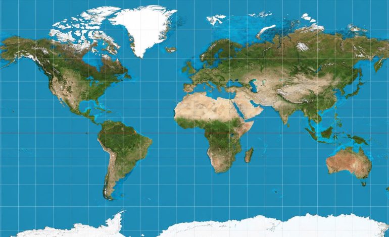
Image courtesy: Wikimedia Commons

New Delhi: India has voted in favour of a United Nations General Assembly (UNGA) resolution promoting wider use of the Equal Earth map projection, which represents the relative size of landmasses more accurately than the widely used Mercator projection. The resolution was adopted on September 4 by 164 votes to one, with six abstentions, while the US cast the only vote against it.
The measure, titled ‘Correct the Map: Rebalancing global cartographic representation and promoting equitable representation of the world’s regions, particularly Africa’, was championed by Togo on behalf of the African Group. It is not legally binding and does not require countries, schools or publishers to abandon the Mercator projection.
How Equal Earth differs from Mercator
The Mercator projection was developed in the 16th century primarily for navigation and remains useful because it allows constant compass bearings to be shown as straight lines. Its drawback is that it increasingly exaggerates the apparent size of landmasses farther from the equator.
As a result, northern regions can look much larger in relation to equatorial areas than they actually are. Africa, for example, can appear roughly comparable in size to Greenland on a Mercator map even though the continent is about 14 times larger, according to a report by Reuters.
Equal Earth, introduced in 2018, is an equal-area projection designed to preserve the relative surface area of countries and continents more accurately. Like every flat representation of the globe, it involves trade-offs, but it is better suited to comparing the actual size of landmasses.
India backs UN resolution
India was among the 164 countries that voted in favour of the resolution. Explaining India’s vote, the first secretary at the Permanent Mission of India to the UN, Raghoo Puri, welcomed the objective of promoting accurate cartographic representation but clarified that New Delhi’s support was for the wider use of equal-area map projections in general, rather than endorsement of a single specific projection.
The resolution encourages wider consideration of equal-area projections, including Equal Earth, when accurate comparisons of geographical size are important. It does not establish a compulsory global map standard or require countries and institutions to abandon other projections for purposes to which they are better suited.
Africa at centre of map debate
Africa has been central to the campaign because the Mercator projection significantly reduces its apparent size relative to landmasses at higher latitudes. The African Union said the resolution, championed by Togo on behalf of the African Group, sought a fairer and more accurate cartographic representation of Africa and other regions.
The African Union Commission has encouraged international institutions, educational systems, publishers and digital platforms to progressively use representations that more accurately reflect actual land areas. According to media reports, Togo has also said it plans to revise maps used in its school geography materials and promote broader consideration of Equal Earth.
The US was the only country to oppose the measure, while six countries abstained. According to Reuters, Washington said the resolution advanced an “ideological agenda” and argued that the General Assembly should focus on issues involving international peace, prosperity and relations among countries.
The US objection was therefore framed around the purpose and political language of the initiative rather than a claim that the Mercator projection provides a more accurate comparison of land areas.
What the UN resolution actually does
The resolution does not ban the Mercator projection and does not make Equal Earth mandatory. Mercator continues to have technical value in navigation because of the way it represents direction, even though it is not an equal-area map.
Instead, the General Assembly has given political backing to wider use of map projections that preserve relative land area more accurately, particularly in education, institutional communication and public-facing maps. Governments and institutions remain free to decide whether and where to adopt such projections.