

India, Nepal turn to drones to map cross-border land occupation. Why has it happened?
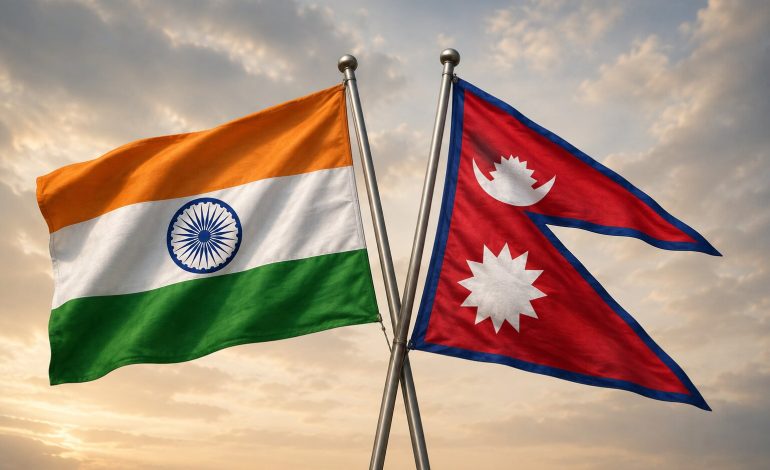

New Delhi: India and Nepal have agreed to complete within three years a joint mapping exercise covering land used or occupied by citizens of one country on the other side of their boundary. The agreement, reached at technical talks in Lucknow on Friday, will employ drones and high-resolution aerial imagery to establish the location and extent of such cross-border occupation.
The decision emerged from the 13th meeting of the Survey Officials’ Committee, which coordinates field-level boundary work under the bilateral Boundary Working Group. The exercise is intended to create an agreed technical record rather than redraw the international boundary or decide the two countries’ larger territorial disputes.
Susheel Dangol, who led Nepal’s delegation, said unmanned aerial vehicles would photograph affected stretches before experts from both countries analysed the images and reconciled their findings. The meeting also approved the annual work plan and budget, with the joint survey expected to begin after the monsoon, around September or October, the Kathmandu Post reported.
The survey will record land cultivated, inhabited or otherwise used by nationals whose holdings now fall across the recognized boundary. It will also help identify occupation of the no-man’s-land, known in Nepal as the Dasgaja, and provide updated evidence for subsequent administrative or diplomatic decisions.
The Survey Officials’ Committee operates below the Boundary Working Group, which is led by the heads of the two national survey departments, while joint field survey teams undertake work on the ground. The mechanism covers boundary pillars, strip maps, satellite reference points, no-man’s-land occupation and cross-border property records.
The seventh Boundary Working Group meeting, held in New Delhi in July 2025 after an interruption of nearly six years, adopted revised procedures for inspecting and repairing pillars and agreed to introduce new surveying technologies. An official Nepali foreign ministry statement described the group as the principal joint body responsible for pillar construction, restoration and other technical boundary work.
Kathmandu subsequently informed its Parliament that four joint field teams were working in different sectors to repair damaged pillars, restore missing ones and compile records of cross-border occupation. Nepal’s Department of Survey estimates that 1,325 of the 8,554 pillars along the boundary are missing, while another 1,956 are partially or completely damaged.
A missing or damaged pillar does not, in itself, change the international boundary because its agreed position can be recovered from coordinates, historical maps and survey records. Its absence can nevertheless create uncertainty on the ground, particularly in densely cultivated areas where settlements, paths and fields extend close to the line.
The issue gained political attention after the prime minister of Nepal, Balendra Shah, told Parliament on May 31 that he had discovered after taking office that citizens from both countries were occupying land across the frontier. Nepal’s foreign ministry later clarified that Shah was referring to cross-border land use and occupation, not conceding an Indian territorial claim against Nepal.
New Delhi responded that nearly 98 per cent of the boundary had been demarcated and that established bilateral mechanisms were available to address the remaining questions. The external affairs ministry also cited changes in the course of the Gandak river as a source of difficulty and ruled out third-party involvement in what it regards as a strictly bilateral matter, according to its June 2 briefing.
The present survey does not cover Susta or the Kalapani-Limpiyadhura-Lipulekh sector, where India and Nepal maintain competing territorial positions. Those areas remain outside the Boundary Working Group’s technical mandate and require negotiations at the diplomatic and political levels.
What is cross-border land occupation, and why has it happened?
Cross-border occupation describes a situation in which a person continues to cultivate, inhabit or use land that lies within the internationally recognized territory of the neighbouring country. It is not necessarily the result of an organized territorial intrusion and does not, by itself, transfer sovereignty over the land.
The problem is most pronounced along riverine sectors where India and Nepal adopted the fixed-boundary principle. Under this approach, the legal boundary remains tied to an agreed historical line or fixed coordinates even when the river that once marked it changes course.
A monsoon flood can shift a channel by hundreds of metres, leaving farmland that was once connected to a village on the opposite bank of the river. Families may continue farming or living on that land because their occupation predates the geographical change, even though the fixed boundary now places the plot in another country.
The distinction between cross-border occupation and encroachment of the no-man’s-land is important. The former concerns land situated across the recognized line, while the latter involves structures, farming or other activity inside the designated buffer adjoining the boundary.
Nepal’s foreign ministry has acknowledged that land presently used by Nepali citizens may, after technical verification, fall within India and that some land used by Indian citizens may fall within Nepal. Its statement to Parliament said both sides tended to assert claims connected to longstanding possession, making an agreed inventory essential before any remedy could be discussed.
The modern boundary originated principally in the Treaty of Sugauli, concluded after the Anglo-Nepalese War and ratified on March 4, 1816, although supplementary arrangements in 1816 and 1860 modified parts of the frontier. Demarcation subsequently proceeded through forests, villages, agricultural land and river systems, producing a border that was never uniformly simple to mark or maintain.
A joint technical committee established in 1981 spent more than two decades surveying the boundary, restoring pillars and preparing 182 strip maps covering all but the principal unresolved sectors. India has said the two sides jointly finalized and initialled maps covering about 98 per cent of the boundary, while a study by a former director general of Nepal’s Survey Department notes that the fixed-boundary system itself produced cross-border holdings when rivers later moved.
The 2007 strip-map exercise reportedly found hundreds of hectares being cultivated or occupied by citizens from the opposite side. Those maps provide a baseline, but aerial imagery is needed to establish what has changed in the intervening years and to match current physical occupation with agreed coordinates.
Even the published length of the frontier varies between official and specialist accounts, partly because of differing measurement conventions for its numerous riverine stretches. Nepal-based records commonly place it at about 1,880 kilometres, while the Union home ministry lists a 1,751-kilometre boundary running through Uttarakhand, Uttar Pradesh, Bihar, West Bengal and Sikkim.
The social character of the frontier adds another layer of complexity. The open-border regime, reinforced by the 1950 India-Nepal Treaty of Peace and Friendship, facilitates movement, employment, commerce and close family ties, but it also means that land use frequently reflects local custom and historical possession rather than a conspicuous international dividing line.
This does not make cross-border occupation unlawful in every case, nor does it validate claims based solely on possession. It means surveyors must distinguish between deliberate encroachment, inherited property, river-induced geographical separation, erroneous cadastral records and occupation made possible by an absent or damaged pillar.
Susta illustrates why river geography can become politically sensitive, although it is excluded from the present technical exercise. The shifting Narayani-Gandak channel has produced competing interpretations of the original boundary, requiring the two governments to consider historical river courses, old maps and treaty records rather than relying only on the river’s present position.
Kalapani, Limpiyadhura and Lipulekh constitute a different and more overtly strategic dispute, centred on competing readings of the source of the Kali river and the western boundary established under the Treaty of Sugauli. Nepal incorporated the territories into a revised political map in 2020, while India rejected the change and maintains that the areas belong to Uttarakhand.
Drones can substantially improve the accuracy of the current exercise by recording buildings, cultivated plots, embankments, channels and remaining pillars at a common point in time. However, aerial images can show who occupies a parcel and where it lies; they cannot independently determine legal title or resolve conflicting interpretations of historical documents.
The resulting database will therefore have to be compared with strip maps, cadastral records, agreed coordinates, historical surveys and evidence of ownership. Only after the two sides authenticate the inventory can their governments decide whether particular cases require restoration of possession, relocation, compensation, administrative accommodation or another negotiated arrangement.
Care will also be necessary to prevent technical corrections from abruptly disrupting border communities whose livelihoods may depend on land used for generations. A durable settlement would need to preserve the international boundary while dealing fairly with residents who may have crossed it through river movement, inherited occupation or errors in earlier demarcation.
The three-year deadline is significant but not unprecedented, and earlier completion targets set in 2015 and 2017 expired because of funding shortages, adverse weather, the pandemic and interruptions in bilateral engagement. Drone imagery may accelerate fieldwork, but completion will still depend on sustained political support, access to disputed plots and agreement over how the collected evidence should be interpreted.
The Lucknow agreement is consequently a practical advance rather than a settlement of the India-Nepal boundary question. Its value lies in separating measurable land-use problems from competing sovereign claims and replacing politically charged assertions with a jointly verified record.