


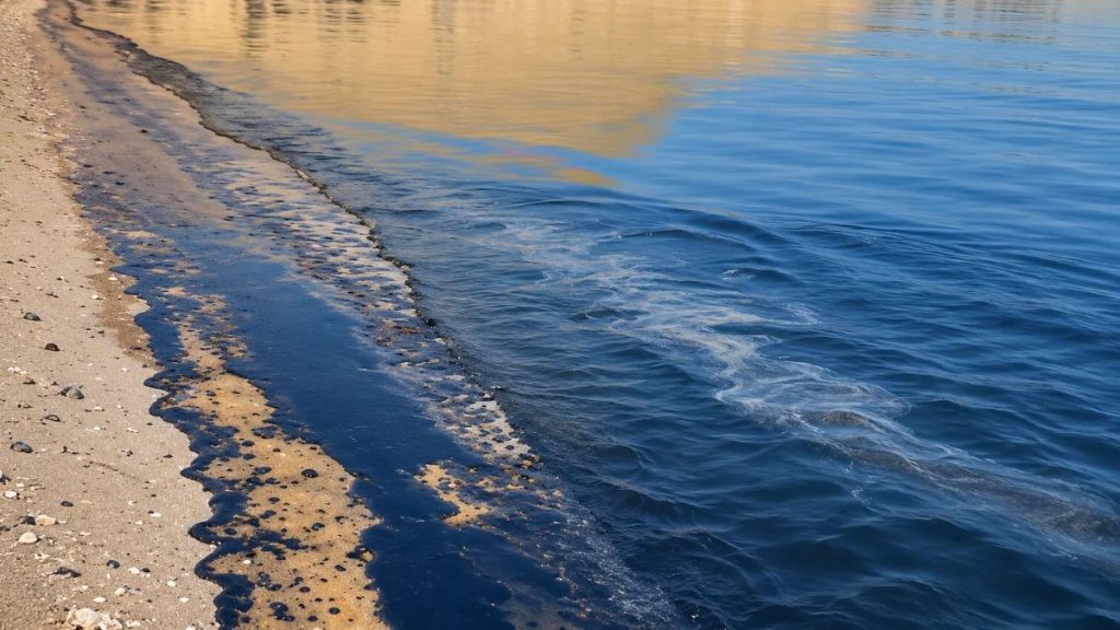
New Delhi: More than 500 possible oil spills have been detected across the Gulf, Strait of Hormuz and Arabian Sea since the US-Israeli war with Iran began on February 28. The pollution is threatening mangroves, coral reefs and fisheries, with scientists warning that its effects could outlast the fighting by decades.
In an investigation published on Thursday, the Guardian, drawing on Greenpeace satellite monitoring, documented slicks near damaged tankers and environmentally sensitive coastlines. Greenpeace disaster-relief expert Nina Noelle estimated their cumulative daily mapped footprints at approximately 20,000 square kilometres; that is a sum of observations on different dates, not one continuous polluted area.
Greenpeace also identified more than 133 attacks on oil tankers during the conflict. October was the worst month for vessel attacks, with more than 30 confirmed or reported incidents around Hormuz, according to the Washington Institute for Near East policy.
Tanker attacks spread pollution across Gulf waters
An October strike on the Gem No. 2 supertanker off the United Arab Emirates produced a slick stretching over 35 kilometres, satellite imagery showed. Pollution spread towards Umm Al Quwain, prompting beach closures, clean-up work and monitoring of desalination facilities.
Authorities in Ras Al Khaimah and Sharjah reopened several beaches after containing pollution from the tanker spill, Reuters reported on Thursday. Reopening coastlines for public use does not mean that submerged habitats have fully recovered.
Off Oman, the tanker Caroline Bezengi ran aground near the Hallaniyat Islands in June following a suspected limpet-mine attack. Greenpeace said satellite imagery from August 4 showed oil spreading across roughly 600 square kilometres, threatening seagrass meadows, coral habitats and turtle-nesting beaches.
Mangroves, coral reefs and marine wildlife under threat
The Guardian also documented a slick near Iran’s Hara mangroves in March and pollution threatening Shidvar Island in April. Oil washed ashore on Qeshm Island in August, while satellite detections appeared near Oman’s Musandam coast and Iran’s Minab river delta.
These areas provide breeding or feeding grounds for turtles, seabirds, fish and marine mammals. However, a slick spotted near a protected habitat does not necessarily establish direct contamination there.
Oil can foul birds’ feathers, smother mangrove roots and harm small organisms at the base of marine food chains. Residues trapped beneath shorelines or in sediment can continue exposing wildlife long after the surface sheen disappears.
Marine biologist, Bernhard Riegl, warned that the Gulf’s shallow waters are already stressed by warming seas, shipping, oil extraction and coastal development. Repeated spills could make recovery particularly difficult for coral reefs and mangroves.
Why environmental damage could last decades
Past conflicts demonstrate how contamination can persist. A 2022 scientific study found oil residues on Saudi Arabia’s Abu Ali Island that researchers considered highly likely to have originated from the Nowruz oil spills of 1983–85.
Determining responsibility for individual oil spills remains difficult. The Wall Street Journal reported that the UAE carried out an airstrike on oil infrastructure on Iran’s Lavan Island. Citing the investigation, The Guardian linked the strike to a major oil spill, although the precise extent of the pollution remains uncertain.
Satellite images can track slicks but cannot alone reveal their full effect on seabed sediments or marine life. Security restrictions have limited on-site sampling, leaving coastal communities, fisheries and conservation authorities facing environmental risks that may endure well beyond any ceasefire.